Technically speaking Isla Socorro is one of the Revillagigedo Islands. However, it is the largest of the four islands that make up this island chain, the others consisting of San Benedicto, Roca Partida, and Clarion (Figure 1). But since ‘Revillagigedo’ is almost unpronounceable in English, most people merely refer to the island chain as the Socorro Islands.
The islands are a popular dive location due to their location as an isolated seamount in the open ocean, thus resulting in it being used by migratory and transient ocean-dwelling creatures. The principal animals passing through this chain are giant mantas, hammerhead sharks, whale sharks, and humpback whales. Resident large animals include silky sharks, Galapagos sharks, whitetip reef sharks, silvertip sharks, and bottlenose dolphins. The primary dive attraction is the giant mantas that cycle through to visit cleaning stations populated by abundant schools of jacks and other fish species. Supposedly the mantas are accustomed to divers and swim overhead so that diver bubbles tickle their undersides, which mimics the action of cleaner fish. All of this provides some pretty exciting dive adventures.
Some of the more inquisitive among us might ask why these remote islands are out in the middle of the deep ocean in the first place. Well, I’m glad you asked that question. Here, in installment 2 of my Dive Site Geology Series, I will explain how and why these islands are here. You can see the first Dive Site Geology article here.
The Socorro/Revillagigedo Hotspot
In a nutshell, the Socorro Islands are a hotspot within a relict mid-ocean spreading ridge. Now, let’s deconstruct that statement. Hotspots are a common feature in the deep ocean and even on land occasionally (Figure 2). They result from a plume of magma rising through the mantle, piercing the crust, and erupting on the earth’s surface (Wikipedia, 2024a). The most common example that Americans are familiar with is the Hawaiian Island chain (Figure 2). Chains such as the Hawaiian Islands do not look stationary because pieces of the earth’s crust are continually moving. This is known as plate tectonics. So as a particular plate moves past a hotspot, a chain of volcanoes will trace the direction and speed of movement of that crustal piece. In our particular case, notice how Clarion Island and Roca Partida are off to the west of San Benedicto and Socorro Islands. This traces the movement of this section of the earth’s crust.
As expected, Clarion Island and Roca Partida do not have recorded eruptions and are in the process of eroding and slowly sinking into the sea from the weight of rock on top of a relatively thin oceanic crust. This is a common occurrence that is well documented in the abundant volcanic island atolls of the southwest Pacific. Roca Partida in particular doesn’t have a very long life ahead of it since it currently only consists of two spires above the surface of the ocean (Figure 3).
The same cannot be said of San Benedicto and Socorro Islands. Mount Evermann on Socorro Island last erupted in 1993 with prior eruptions in 1951, 1905, 1896, and 1848. Vulcanologists think they can trace eruptions back at least to 3090 BC (+/- 500 years) (Wikipedia, 2024b). San Benedicto has two large craters, the southern of which is currently active. Its most recent eruption was in 1952 and was so large that it wiped out all life on the island. It has since been repopulated naturally by species from either the mainland or other islands, that is except for the San Benedicto rock wren which became extinct (there are other species of rock wren on other islands of this chain) (Wikipedia, 2024c).
The East Pacific Rise
The East Pacific Rise (EPR) is a divergent plate tectonic boundary, which means that new ocean crust is being created along its entire length and the crustal plates on either side are moving away (Wikipedia, 2024d) (Figure 4). In the Mexican portion of the EPR, the plate to the west is the Pacific Plate and to the east is the Cocos Plate. The Cocos Plate in turn is being subducted beneath the North American Plate in a feature known as the Middle America Trench (this is known as a ‘convergent’ plate tectonic boundary) due to the fact that the North American Plate is moving westward and will eventually completely consume the Cocos Plate.
Currently the EPR is located some distance to the east of the Socorro Islands (Figure 1). This is because 3.5 million years ago the EPR shifted to its current location, having previously been located directly underneath the Socorro Islands. Today this relict feature is known simply as Mathematicians Ridge. Lateral translation (or jumping) of spreading centers sometimes does occur due to reasons that are not well understood but are likely related to the fact that the oceanic crust is thin and weak in the vicinity of these spreading centers and if the mantle plumes feeding them shift slightly then the spreading center will also shift.
Geology (and dive experience) of the Socorro Islands

Let’s take a tour of what sights a diver might see when visiting these islands on a dive trip. Since the boats all come from Cabo San Lucas, the first island you reach will be San Benedicto. It is common to visit a popular site on the south end of the island called El Canyon (Figure 5). From the sheltered bay there you get a great view of the active volcano called Volcan Barcena (Figure 6). This barren landscape reminds one of being on the moon or some other similarly desolate place. The dives here are on volcanic rubble bottoms that have lots of fish but the primary attraction are the schools of sharks that make VERY close passes to divers (Figure 7) because we are associated with possible food handouts (not because we ARE food).

The Boiler
You might then be treated to a dive site on the other side of the island called The Boiler. Here is where you get your first chance to see giant mantas performing acrobatics above you. The pictures from here often have steep volcanic cliffs as a compositional element, which make for some very dramatic images (Figure 8). I’ve seen some company advertising literature framed on these volcanic walls, and for good reason (Figure 9)

Roco Partida
Next is Roca Partida. The time I went we spent two days diving on the same ‘rock’. That gives you an impression of what we thought of this isolated seamount in the middle of the Pacific. The underwater environment is very similar to The Boiler in that you swim around the seamount waiting for the mantas to show up. While you’re waiting there is lots of fish and sharks to photograph. Here you use the same compositional technique as you did previously by including rock outcrops on the seamount whenever possible (Figure 10). An additional world-famous ‘must-see’ picture from here is of resting white-tip reef sharks (Figure 11) which have the unique ability to lie on the bottom while sleeping, unlike most sharks that cannot breathe unless they are moving.

Socorro
Eventually, you make it to the southernmost island of Socorro, the largest island in the chain. Here the geology is very interesting because you see layered igneous stratigraphy wherever you look (Figure 12). There are two special things you might experience here. First is a night snorkel behind the boat with a whole herd of silky sharks just beneath the surface (they hunt flying fish, so the trick here is not to act like one so they don’t take a bite out of you). The second is a Zodiac ride to the rugged coastline where you go on a tour of the dramatic landscape up close and personal, which as you can imagine is like a kid in a candy store for a geologist (Figure 13).
This all adds up to an experience not to be missed in this lifetime.


References
Buck, W. R., C. Small, and W. B. F. Ryan (2009), Constraints on asthenospheric flow from the depths of oceanic spreading centers: The East Pacific Rise and the Australian-Antarctic Discordance. Geochemistry Geophysics Geosystems, 10, Q09007, doi:10.1029/2009GC002373.
Wikipedia, 2024a: Hotspot (geology) – Wikipedia, accessed in February, 2024
Wikipedia, 2024b: Socorro Island – Wikipedia, accessed in February, 2024
Wikipedia, 2024c: Revillagigedo Islands – Wikipedia, accessed in February, 2024
Wikipedia, 2024c: East Pacific Rise – Wikipedia, accessed in February, 2024
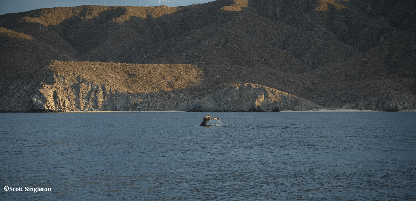
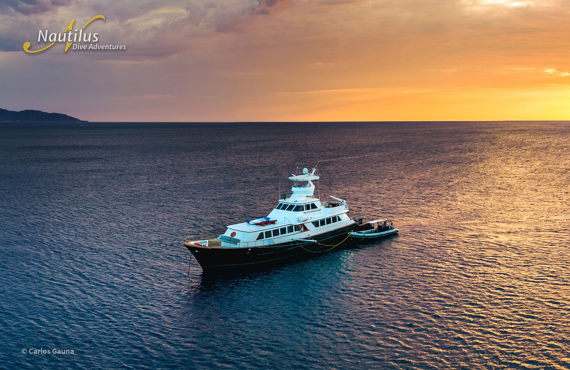 Recently, I was onboard the Gallant Lady, a 116′ dive yacht. The exciting ‘Orcas and Mobulas’ trip traverses the southern Sea of Cortez in the vicinity of La Paz, visiting Cerralvo Island to the east of La Paz, Espiritu Santo Island which is close and to the north of La Paz and San Francisco and San Jose Islands further north. The format for this excursion is for the boat to cruise around between the islands and the mainland looking for whales, orcas, and schools of mobula rays. And of course making visits to each of the sea lion colonies in this portion of Baja California, which some claim to be the highlight of any trip to these parts because sea lions enjoy the presence of divers and will goof around and pose for the enjoyment of their guests.
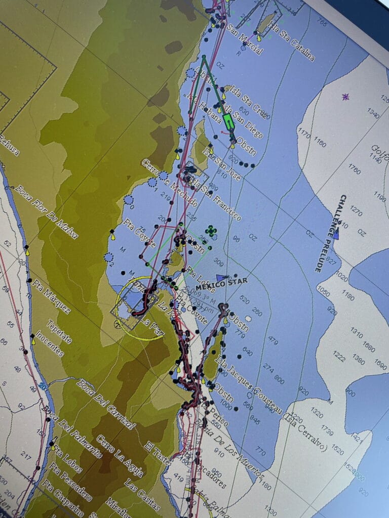
 This portion of Baja California is very arid with little rainfall, meaning that rock exposures are plentiful and commonly in the form of sheer cliffs rising out of the sea. Most of the area consists of intrusive basalts (meaning they did not erupt on the surface) that tend to be dark gray or brownish and massive (meaning they lack detail). Basalts in general are oceanic in origin because they originate in the mantle (below the continents). We can tell this because they lack silica (such as quartz which is silica dioxide) which only occurs within continental landmasses.
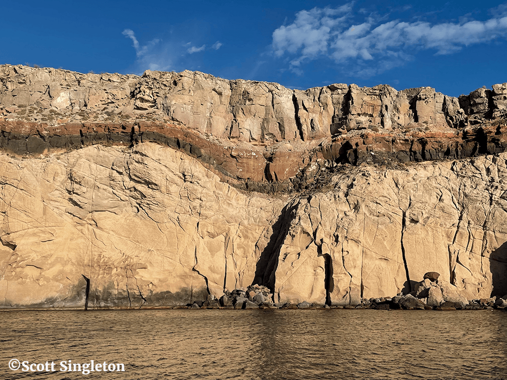 There were also some extrusive (meaning they erupted) ash and lava flows. This was clearly seen on the northern portion of Espirito Santo Island when we visited a sea lion colony called La Reina. Here the lowest unit (that we could see at sea level) was a light-colored ash that was covered (unconformably) by a thinnish dark brown lava flow followed by a reddish-brown lava flow, then a soil zone (seen as a thinnish light red and white layer) which was in turn covered by a massive grayish lava flow.
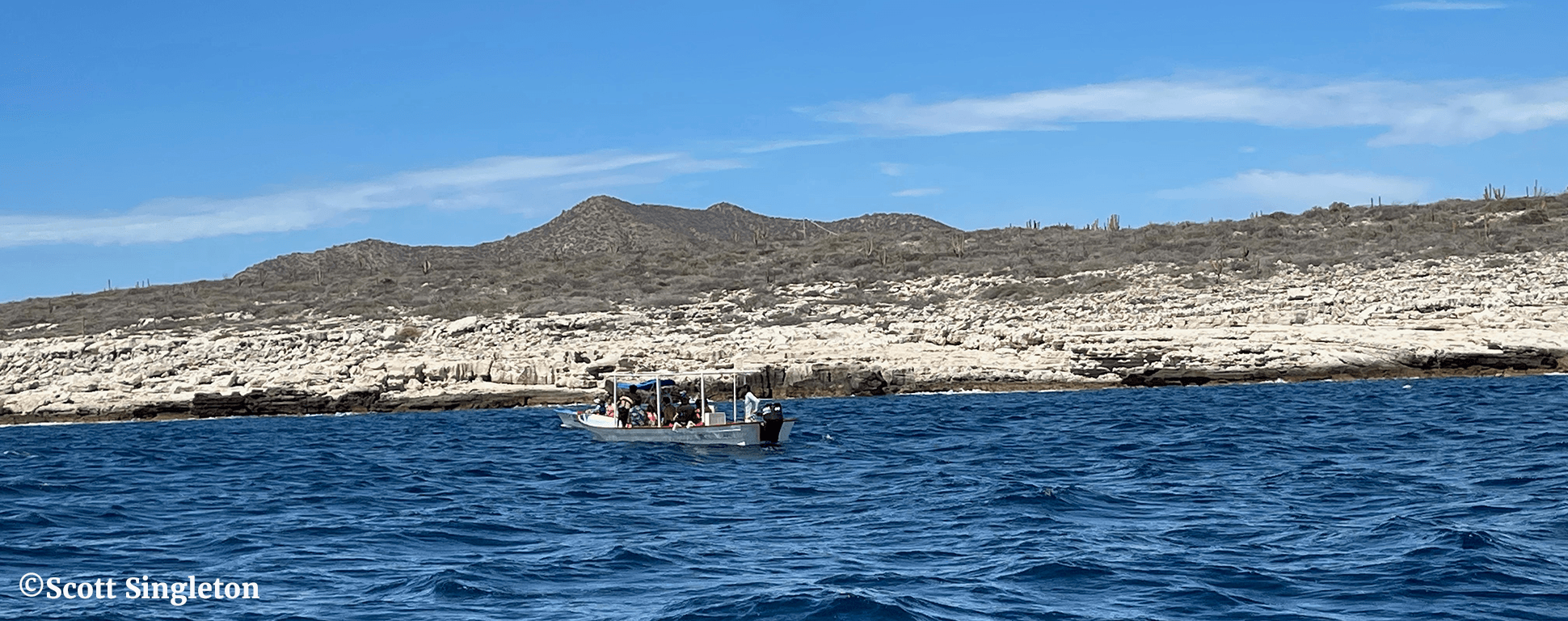 The only sedimentary rocks were seen on the mainland coast to the east of La Paz (across from Cerralvo Island) where recent sandstones have been uplifted from the sea due to the tectonic movement of Baja California to the northwest, angling obliquely away from the Mexico mainland. These sandstones show clear layering indicating how they were deposited. The layers sometimes change dip and truncate one another which reveal changes in flow direction. Units like this can be deposited by streams and rivers (called ‘fluvial deposits’) but these sandstones were deposited offshore when sediments carried by these rivers flowed into the sea and were dispersed.